|
Town Hall
16 School St.
Allenstown, NH
603-485-4276
Check town web site for current business hours.
Bear Brook State Park, a Place for All Seasons
Bear Brook State Park is the second largest of the New Hampshire state parks at over 10,000 acres, but it is the largest developed park. The large acreage covers most of the eastern side of Allenstown along Deerfield Rd. The campground and the rest of the park are in Deerfield.
The park offers picnic grounds, swimming, canoeing, fishing, a woodland archery course, a fly fishing pond, a campground, and miles and miles of trails for hiking and mountain biking in the warmer months, and cross country ski trails and snowmobile routes for the winter months.
The following on page links give summaries of the opportunities you can find at Bear Brook State Park. For more information, go to the Bear Brook State Park web site.
Directions
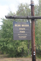 From Manchester or Hooksett, NH proceed north on Routes 3 & 28 to Allenstown. At the fork just past Sully's Market, go right onto Route 28 North. From Concord, take Route 3 south to Allenstown. At the traffic lights just past Aubuchon's Hardware, take a left onto Route 28 North.
In about three miles, take a right at the Bear Brook sign onto Deerfield Rd.
In one mile, the park's main toll booth is on the right. This is the location for Catamount Pond, a swimming area, picnic areas, and some hiking trails.
At 1 1/2 miles, the Old Allenstown Meeting House is to the left and to the right on Depot Rd. are the New Hampshire Antique Snowmobile Museum and the Richard Diehl Civilian Conservation Corps (CCC) Museum.
At about three miles, take a right onto Podunk Rd. After stopping at the toll booth, take a left turn at teh Ranger Stataion to go to the state campground (three miles away). A right turn takes you to a parking lot for hikers and mountain bikers. Go straight on Podunk Rd. (when open) to get to more hiking trails. At about one mile past the Ranger Station, Hayes Field is a popular starting point for many trails.
Fees
For all NH state parks, admission fees for day use are $4.00 per adult, and $2.00 per children ages 6 to 17. There is no admission charge for NH residents age 65 and older, and children ages 5 and under. If you are 65 or older, ask for attendant for the Senior Pass.
Season passes are available as follows.
- Individual Season Pass - $60.00 + $4.50 shipping. This pass allows free entry for one person.
- New Hampshire Resident Family Season Pass - $105.00 + $4.50 shipping. This pass allows free entry for two (2) adults and up to four (4) dependents.
- Non-Resident Family Season Pass - $120.00 + $4.50 shipping. This pass allows free entry for two adults and up to four dependents.
- Individual Youth Season Pass - $25.00. This pass allows free entry for one child ages 6 to 11.
- State Parks Plate - $85.00 (plus $8.00 plate fee (first time), plus normal state fee). This plate allows free entry for your car and passengers.
Hiking Trails
The park contains miles of hiking and biking trails, which also serve as cross country ski trails in winter.
Getting Lost
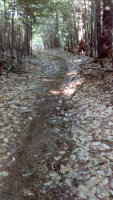 Getting lost in Bear Brook State Park is easy if you fail to pay attention to its basic landmarks and don't bring a compass. On a sunny day, use the sun to identify directions; if cloudy, then use a compass.
Avoid the situation where you have to ask a passer-by, "How do I get back to my car?"
Along the north side of the park, the Campground Road, Bear Brook, and Deerfield Rd. all run east to west. On the east side are Spruce and Beaver Ponds, the state campground, and South Rd. in Deerfield. Far to the west is Catamount Hill, Catamount Pond, and then Route 28, which runs north-south.
Podunk Rd. enters the park from Deerfield Rd. and runs generally south through the middle of the park, starting from Deerfield Rd. on the north side and soon becoming a gravel road. Landmarks along Podunk Rd. are Hayes Field (right), Spruce Pond Rd. (left), and the old 4H Camp at Bear Hill Pond (right at the south gate). In 2018, they started renting a few cabins on the pond so the gate to the camp is now open.
Getting Found
 If you don't have a map or compass and are unsure of where you are, head north until you come to either Podunk Rd., the Campground Rd., or Spruce Pond Rd. and then look for another hiker to help you get back to your starting point. The next time you hike in the park, plan your route and frequently ask yourself, "Do I know where I am?"
Using a Trail Map
A printable trail map is available from the state park web site, but many of the trails have been rerouted since the map was drawn. For example, the Salt Lick Trail touches Podunk Rd. only once and the Little Bear Trail is totally different north of the Hayes Farm Trail.
Hiking Categories
Most trails are easy to moderate. The Catamount Trail up Catamount Hill and the Ledge Trail around Bear Hill might be considered moderate to difficult.
Bugs
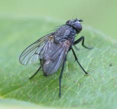 Starting in early May, black flies become a daytime annoyance. They have an uncanny ability to fly behind your glasses or into your ears. They usually disappear by mid-June. In late May, ticks and mosquitoes become additional pests. These latter two insects persist into the cold weather in the Fall. At least you can hear the mosquitoes closing in.
For all these insects,you might want to use an insect repellent. DEET is quite prevalent in many products but has been cited in various studies for harmful effects on the nervous system and for melting certain plastics. Another choice is Picaridin at about 20%. This is similar to an essential oil found in black pepper. Another choice is oil of lemon eucalyptus at about 30 percent. Lab tests have shown these two to be as effective as DEET but with fewer negative effects. The choice of course is up to you. One article worth reading is at martinewhite.com (June 2015).
For ticks, you should always perform a quick inspection during and at the end of your hike. Dogs are especially prone to picking up a lot of ticks. One key item to carry is a roll of transparent tape or masking tape, AKA the Tick Terminator. When you remove a tick, wrap it tightly in a small piece of tape and bury it. The tick will never bother anyone else.
Favorite Trails
Here are some of the more popular trails for hiking and mountain biking. Where some trails pass through wetlands or over small brooks, the New England Mountain Bike Association (NEMBA) has constructed boardwalks or low bridges. Thank you!
For the following trails, refer to the preceding Trail Map.
Hemlock Trail through the "Spooky Woods"
From the parking lot off Podunk Rd., follow the Salt Lick Trail east to a trail crossing. Go left and within 100 ft. take the Hemlock Trail to the right. Just after a side trail leading to the old sand pit, you step down a stone ramp and then follow a narrow trail across a steep slope as it slowly descends to a point near Bear Brook, which is below on the left.
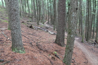
The "Spooky Woods" consist of a dense stand of pine and hemlock with dead trees and pine needles scattered on either side of the trail. The scene becomes especially gloomy in late afternoon.
At the low point of the trail, just after a long switchback, a footbridge takes you across a small brook that originates from the Fly Fishing Pond. Bushwack downstream to see where it empties into Bear Brook. The trail ascends along the left side of the brook, then turns left and winds its way to a broad plateau thick with hemlocks.
After a long switchback, the trail heads east and then southeast until it meets the start of the Broken Boulder Trail. From here you can continue east on the Hemlock Trail or south on Broken Boulder.
To loop back to the parking lot, head east (right) on the Broken Boulder Trail. Very shortly, you come to a fork. To the left, the Pitch Pine and Broken Boulder Trails overlap and soon diverge, but both eventually cross the Campground Road.
Go right on the Pitch Pine Trail. In several minutes, you cross a very small hidden brook and then pass through the archery course. Cross the small parking lot and go around the right side of the Fly Fishing Pond.
Continue on the wide gravel road through the old sand pit and finally along the Salt Link Trail to the Ranger Station and parking lot.
Hemlock Trail to the northeast plateau
From the junction of the Hemlock and Broken Boulder Trails (see preceding description), keep to the left on the Hemlock Trail which ascends a broad plateau on the northeast corner of the park. In about 3/4 mi. the trail passes close to an escarpment on the left from which you have a view of Bear Brook hundreds of feet below.
The trail then turns right through an open field and joins an old carriage road. This road heads south keeping Bear Brook (now a broad wet meadow) on the left until it ends at the Campground Road.
From here, turn right and follow the either the Campground Rd. or the Campground Trail for about 1 1/2 miles to the parking lot.
Loop: Broken Boulder Trail-Smith Pond-Pitch Pine Trail
From the parking lot off Podunk Rd., go 1 mile east on the Campground Rd. to the Broken Boulder Trail crossing. This is where the Guardian of the Forest resides. This carved figure sits in a tall stump just off the left side of the road. (See the following section on Wood Carvings.)
Head south (right) on this trail. In less than 1/2 mile, the Broken Boulder Trail merges with the end of the Pitch Pine Trail (left). Just before the merge, notice the curious arrowhead-shaped root in the ground pointing the way.
Continue on the Broken Boulder Trail for 1/4 mile and go right on the path to the Smith Pond Shelter. This shelter was built in 1937 by the Civilian Conservation Corps, which was a public work relief program that operated from 1933 to 1942. It gave public jobs to unemployed, unmarried men who worked on projects on government-owned land. It was rehabilitated by Boy Scout Troop 138 in 2012. A steep log stairway goes down to the edge of Smith Pond.
Sit in the shelter and rest a while. Partake of some refreshment you may have brought with you. Sit quitely and listen to the sounds of the forest.
For the return trip, at the fork, go right onto the Pitch Pine Trail. Just before you reach the road, notice the large bow-shaped tree on the right. Turn left at the road and follow it back to the parking lot.
Loop: Podunk Rd. to Little Bear Trail
From the parking lot off Podunk Rd., head south on Podunk Rd. [To be continued.]
Loop: Podunk Rd. to Middle Salt Lick Trail to Lower Salt Lick Trail [To be continued.]
From the parking lot off Podunk Rd., head south on Podunk Rd.[To be continued.]
Loop: Podunk Rd. to Upper Salt Lick Trail to Bobcat Trail
From the parking lot off Podunk Rd., head south on Podunk Rd.[To be continued.]
Podunk Rd. to Hayes Farm Trail to Hayes Marsh
From the parking lot off Podunk Rd., head south on Podunk Rd.[To be continued.]
Catamount Hill Trail
From the parking area across from the Toll Booth, take the connector trail to the One Mile Trail.[To be continued.]
Archery Course
For archers or toxophilites (a late 18th-century English archery society), who would like to practice target shooting or hone their skills for bow hunting seasons, a 15-target woodland archery course provides 2D target boards that are located along a wooded trail that provides realistic, woodland shooting situations.
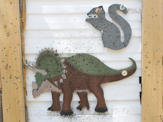
A four-target practice range next to the Fly Fishing Pond allows you to take some preliminary shots to warm up before heading onto the woodland trail. Kids will enjoy the 2D dinosaur targets, such as this one in which a gray squirrel is attacking a Triceratops dinosaur. This is an interesting concept: shooting at animals that no longer exist.
Fly Fishing Pond
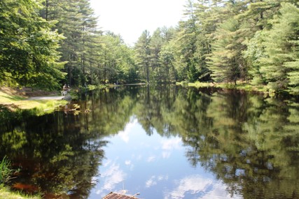
For the fly fishing enthusiast, the Archery Pond offers fly fishing for trout. It is located about 1/2 mile up the Campground Road on the left. There is a paved walkway leading to a concrete pad for handicapped users. On a good day, the pond is dotted with fishermen trying their hand at catching a fish. Several can be seen along the left shore.
Camping
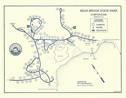
The park campground offers 101 wooded campsites situated near Beaver Pond. Amenities include a camp store, canoe rentals, coin-operated showers, ice, firewood, and a dump station. A hiking trail (approx. 1.5 mi.) circumnavigates the pond.
The campground is open from May 6 through October 29 and you can make reservations by calling ReserveAmerica at 1-877-647-2757. The campground is on the eastern side of the park, which is within the town of Deerfield.-
Wood Carvings
Several years ago, master chainsaw artist Clayton George of Tamworth, NH created some beautiful animal carvings at several locations in the park. Click on any of the following images to view a full-sized photo.
If you look at a trail map of the park, there are a lot of trails named for animals: Ferret Trail, Little Bear Trail, Bobcat Trail, Chipmunk Trail, Hedgehog Trail, Lynx Trail, and Beaver Pond Trail. Don't these trails need carvings too? The next time you see the park rangers, ask them to hire Clayton George to do more carvings along these trails.
Bear Ranger
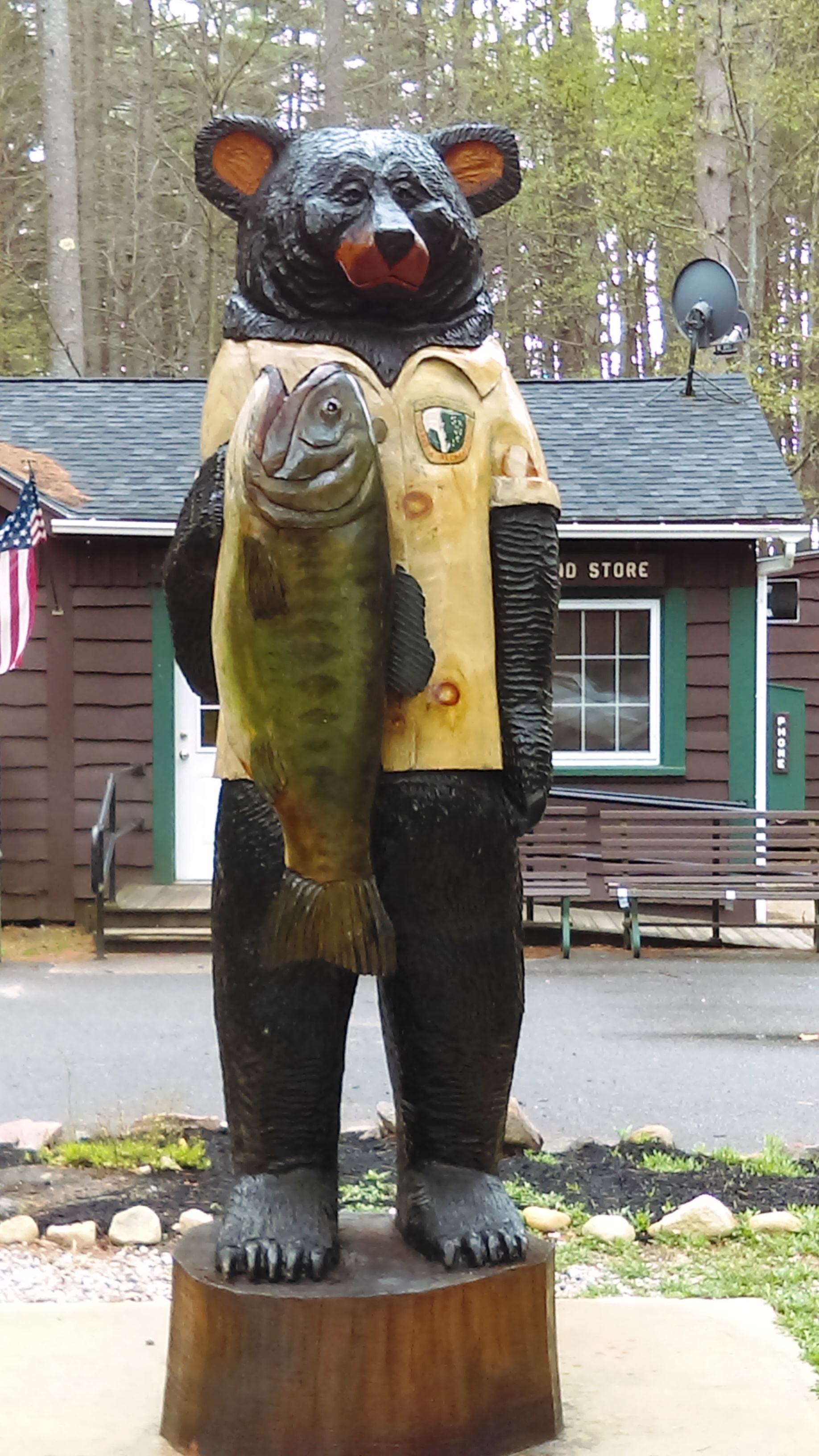 After traversing the three-mile woods road from Deerfield Rd., this gigantic eight-foot-tall carving greets visitors at the entrance to the Bear Brook State Campground, located along the shore of Beaver Pond in the Deerfield portion of the park.
It is dressed in a park ranger uniform and is holding a huge fish, much bigger than anything you might catch in Beaver Pond. Beyond the "park ranger" is the campground store, which stocks many provisions for the convenience of campers. This comes in handy since the nearest food store is about seven miles away.
Stumpie Bear
 This carving is tucked in a stump to the right of the Bear Ranger. Both bears were carved into trees that the park was going to cut down.
Rocky Raccoon
This easily overlooked carving inhabits the end of a fallen log on the Campground Trail that runs east from the fly fishing pond toward the campground. The carving lies below one of the archery caution signs. The fine detail is definitely worth a view from either side. Please don't kiss the raccoon.
Guardian of the Forest
This carving sits in a tall tree stump at the intersection of the Broken Boulder Trail and the Campground Road. It would make a cuddly Teddy Bear if it wasn't made out of wood (and if it didn't have those sharp claws). Please don't hug the bear.
